

3D Laser Scanning (LiDAR)Services
3D Laser Scanning Services in Southern California
3D laser scanning via LiDAR technology allows AAB to document the existing conditions of any project, regardless of complexity with millimeter precision. By strategically moving our scanners throughout a jobsite and collecting millions of individual data points, we can render a precise 3D point cloud of any space. Our custom scanning solutions even allow us to survey areas that many won’t consider, such as crawlspaces, attics, interstitial spaces, and subsurface areas. Simply put, if our equipment can see it, we can most certainly measure it. Below, we’ve detailed the 3D laser scanning services offered by our company:
Point Clouds
The product of raw scan data meticulously stitched together by an AAB surveyor, checked against our accuracy standards, then exported to the format of your choice.
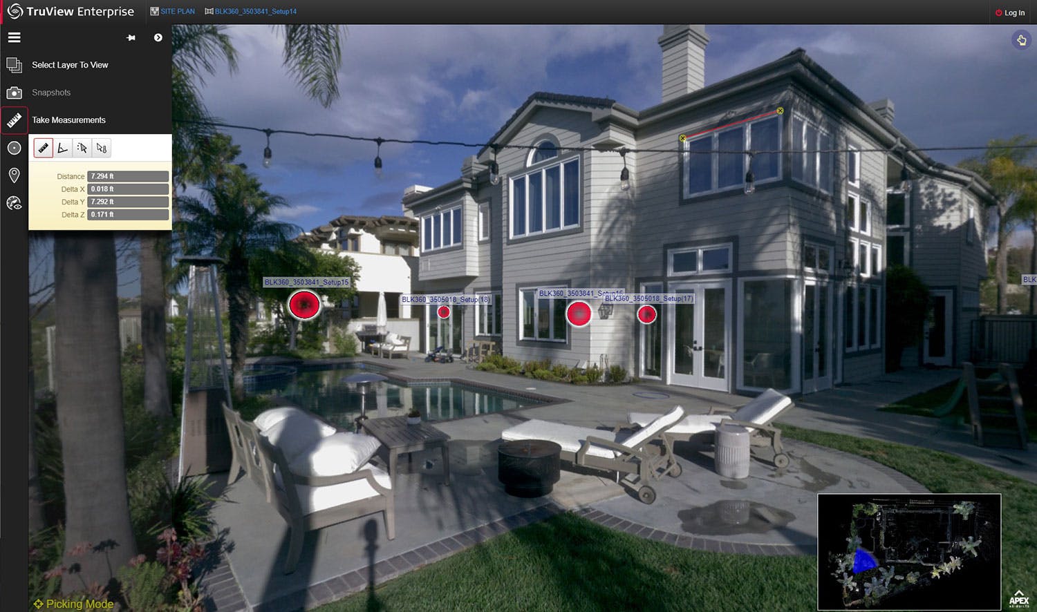
Leica TruView
Standard with all AAB site visits, 360 photo tours offer a customer friendly, photorealistic point cloud viewer that enable our clients to easily measure, markup, and share any point cloud with no prior experience required.
Orthophotos
Scaled sectional cuts of point cloud data in .tiff, .png, or .jpg formats.
Subsurface LiDAR Inspections
Do you have subsurface areas in need of inspection? Traditional inspections result in limited measurements with many areas being inaccessible altogether. We can provide the full picture far more quickly and safely with our custom LiDAR scanning solutions. Shafts, manholes, catch basins, confined spaces, and storage tanks may all be remotely inspected in 3D with incredible accuracy.
Benefits of Laser Scanning for As-Built Drawings
Enhanced Visualization
With the use of 3D laser scanning, we can create accurate and detailed models of existing areas. This allows designers, architects, and engineers to better understand the project site and make informed decisions during the design phase. We can even scan areas that may be hard to access, such as a building's crawlspace or attic.
Improved Efficiency
Using other techniques for data collection can be time-consuming and often leads to errors and discrepancies. With 3D laser scanning, we can quickly capture accurate data from multiple angles and locations, reducing the need for return visits to the job site. This results in faster project completion times,improved efficiency, and minimal disturbance to occupied spaces.
Optimal Accuracy
By using 3D laser scanning technology, we can obtain incredibly accurate measurements and the most thorough data technologically possible. Our in-house system for conducting LiDAR surveys ensures your data is always backed up by an accuracy report and will have guaranteed tolerances. This point cloud data and our methods for collecting it far reduces the potential for human error and ensures that any as-built drawings made from it will represent the existing conditions on-site.
Why Choose AAB
Apex As-Builts has over ten years of industry experience, and we prioritize attention to detail and efficiency on every project. We partner closely with commercial,residential, and industrial clients to offer support at every step of the process, starting with data collection and continuing long after delivering as-builts in the format of their choice.. We use a collection of robust, high-end laser scanning equipment to ensure accurate and precise data collection; no project is too complex for us. Our experienced professionals are well-versed in the latest technology and software to provide you with detailed and comprehensive as-built drawings.
Contact Us
Contact our team if you have questions about our 3D laser scanning services in Southern California or would like to request a quote. We are always happy to provide a consultation and find the best solutions for your needs. You'll reach our team by calling (562) 443-7337 or emailing office@apexab.com.
360 Photo Tours
Included standard with any of our 3D Laser Scanning (LiDAR) deliverables is a virtual 360 photo tour that allows you to view and measure anything that our LiDAR technicians were able to document. Our in-house team will host this point cloud-viewing software and share the link with you shortly after your on-site survey is complete, so that you can access it at any time, from any place.
This software is easy to navigate, and you do not need CAD or 3D skills to use it. Other benefits include the following:
- Easy remote viewing of structures, including crawlspaces and attics (if included within scope)
- Accessibility from any device
- Enhanced collaboration with your work team
- NavVis IVION and/or LeicaTruView format (dependent on scope)
You can share the link to your 360 photo tour with all members of your team, meaning they don’t have to waste time visiting the worksite to inspect spaces that the Apex team has already documented.
Contact us today to learn more about building and floor plan measurement services in Southern California or to request a quote. You may reach the Apex As-Builts customer service team by emailing office@apexab.com or calling (562) 443-7337.